Forecasters: Karen could strengthen
Published 10:34 pm Thursday, October 3, 2013
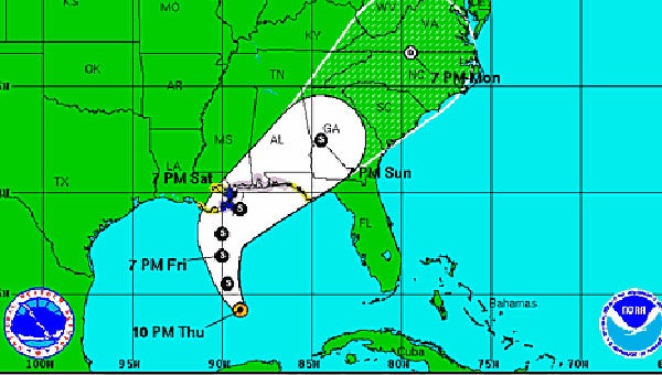
Tropical Storm Karen is expected to move slowly northward over the central Gulf of Mexico Friday, National Hurricane Center forecasters said late Thursday night.
Forecasters said the storm could strengthen late Friday and early Saturday to near hurricane strength.
The storm had maximum sustained winds of 65 mph and was tracking northwest.
A hurricane watch is in effect for the coast from Grand Isle, La., to west of Destin, Fla.
A tropical storm warning is in effect from Grand Isle to the mouth of the Pearl River.
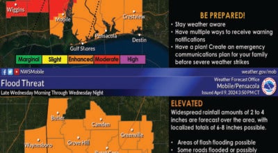
Storm surge from the mouth of the Mississippi to Mobile Bay could be 2 to 4 feet, forecasters said.
Karen is expected to produce 4 to 8 inches of rain over portions of the central and eastern Gulf Coast through Sunday night, mainly near and to the right of the path of the eye of the storm.