More weather issues on tap Wednesday, Thursday
Published 12:25 pm Tuesday, April 12, 2022
|
Getting your Trinity Audio player ready...
|
Officials from the National Weather Service for the Mobile and Pensacola area, has updated information on a forecast for with the risk of severe weather over the next two days.
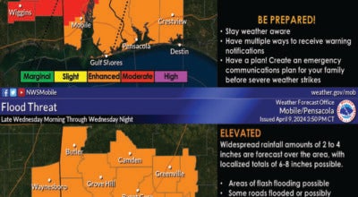
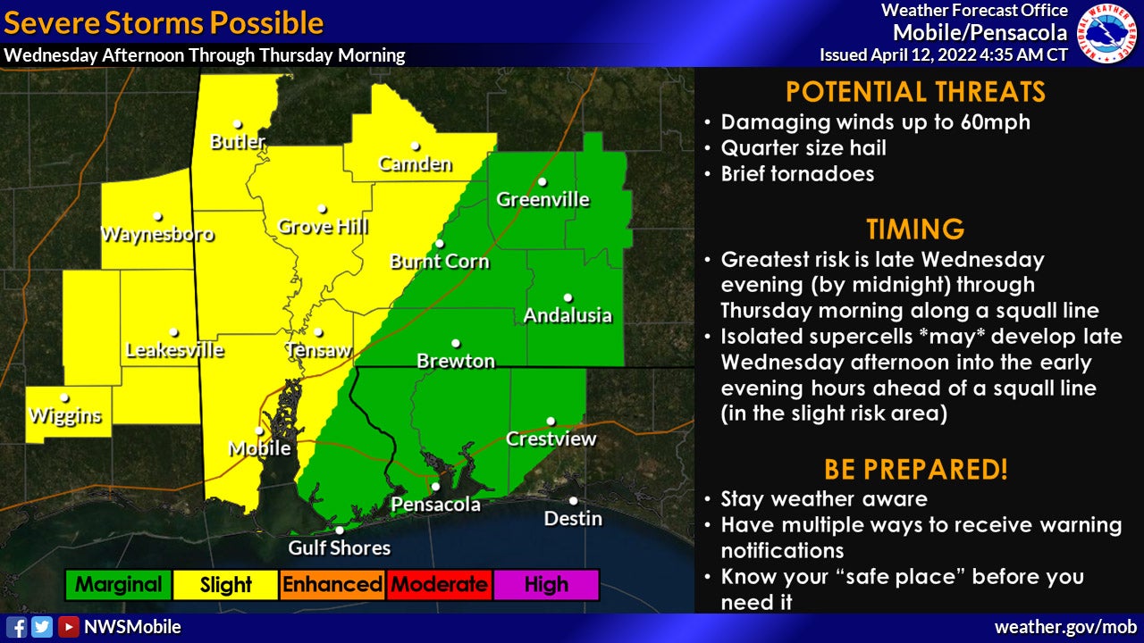
Regarding the risk of severe weather and flooding for Wednesday and Thursday, the refined the timing now includes the possibility of two rounds of storms. Additionally, increasing southerly flow will keep the rip current risk HIGH through Friday with surf heights bumping up to 4-6 feet by mid-week.
Here are the details…
- WHAT and WHEN: Two rounds of strong to severe storms are possible. The first round of storms is very conditional – meaning we aren’t sure if it will actually materialize. Isolated supercells *might* develop late Wednesday afternoon through the early evening in the slight risk area. The greatest risk for severe weather will be associated with the second round of storms late Wednesday evening through Thursday morning as a squall line enters the area. The squall line will likely enter southeast Mississippi around midnight and slide across communities generally west of I-65 through the overnight hours. Storms along the squall line will be capable of producing winds up to 60mph, quarter-size hail, and brief tornadoes throughout the overnight hours. As the squall line slides east of I-65 by sunrise, the environment will be less favorable for severe storms. Storms will also be capable of producing very heavy rainfall and localized flash flooding is possible, especially across low-lying and urban areas. The greatest risk for flooding will be overnight into early Thursday.
- WHERE: The greatest potential for severe weather is generally west of I-65. The greatest potential for flooding is across the entire area.
- CONFIDENCE: Confidence is very low that the first round of storms will materialize. Confidence is increasing in the threat of strong to severe storms along a squall line overnight into early Thursday. Confidence continues to increase in the potential for localized flash flooding.