Weather may be shaky Tuesday evening into Wednesday
Published 1:18 pm Tuesday, November 29, 2022
- Tuesday evening, night weather outlook
|
Getting your Trinity Audio player ready...
|
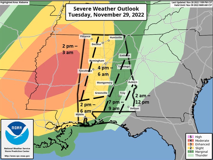
Weather-watchers with the Alabama Emergency Management Agency are keeping an eye on developing weather conditions across most of the state today.
Several waves of thunderstorms are forecast to move across the state this afternoon and evening, followed by a line of storms late tonight into Wednesday morning.
During the afternoon hours, clusters of thunderstorms will move from west to east across Alabama. The highest threat of severe storms will be west of I-65. West of I-65 and north of Hwy 80, large hail to golf ball size and damaging straight-line wind gusts are possible. West of I-65 and south of Hwy 80, the air will be more unstable and supercells with potential tornadoes are possible.
After 9 pm, additional clusters of thunderstorms will enter the western portions of the state and eventually form into a solid line as it moves southeastward late Tuesday night through Wednesday morning. It is these storms across the western half of the state where the greatest severe weather threat including tornadoes will occur. A couple of tornadoes could be at least EF2 intensity and straight-line winds could gust over 70 mph, especially near the Mississippi/Alabama state line.
Keep a way to receive emergency weather warnings and be prepared if weather conditions worsen finding safe, stable cover from the storms.