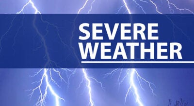
Tuesday p.m., Wednesday a.m. storms could pack a punch
Published 2:45 pm Tuesday, January 24, 2023
As you prepare to end your day on Tuesday, you may want to make some plans to receive alerts regarding severe weather.
If you haven’t downloaded the RedZone Weather app, to your devices, now may be a good time to do that with the impending severe weather in our area. The app has a variety of alerts that can be set by the user to insure weather warnings can be received. A link to download the app can be found at the conclusion of this article.
According to information provided by local meteorologist Spinks Megginson, some storms associated with an approaching system to our area may produce an abundance of rain, strong winds and even some damaging wind gusts. RedZone Weather, Megginson’s own local weather network, provided the following information:
SEVERE STORMS LIKELY OVERNIGHT INTO EARLY WEDNESDAY; TORNADOES POSSIBLE… Thunderstorms capable of producing tornadoes and damaging wind gusts will become possible across our local area late this evening into the overnight hours of early Wednesday morning as a dynamic weather system approaches from the west. It is imperative that we all have a way to hear urgent weather warnings overnight as some of the thunderstorms may be particularly intense. The Storm Prediction Center continues to include much of our local area in their Level 3 (out of 5) enhanced severe weather risk, meaning severe thunderstorms are likely to happen. In addition to the severe weather risk tonight, strong winds will be possible out ahead of the thunderstorms this afternoon into this evening. An uncommon High Wind Watch is in effect for the entire local area. Winds may gust to 40-45 mph this afternoon into this evening. More details are below.
SEVERE WEATHER TIMING – OVERNIGHT… The timing for severe weather overnight remains on track: This severe weather risk will almost exclusively happen in the overnight hours tonight into early Wednesday morning. Midnight to 7AM Wednesday is the seven hour time frame when strong to severe thunderstorms are most likely to happen across southwest Alabama and northwest Florida. Please have a device (like a NOAA Weather Radio) or a mobile phone with Wireless Emergency Alerts (WEAs) enabled. The WEA alerts are the AMBER Alert-style noises that are extremely loud and are issued by the National Weather Service. You’ll need something that can wake you up in case your specific location goes under a tornado warning or severe thunderstorm warning.
LEVEL 3 (OUT OF 5) SEVERE WEATHER RISK; LEVEL 2 RISK ELSEWHERE… The Storm Prediction Center continues to include a large chunk of southwest Alabama and northwest Florida in their Level 3 (out of 5) enhanced severe weather risk zone. This means that scattered severe thunderstorms are likely with a chance of a few particularly intense storms. Strong (EF2+) tornadoes will be possible under certain scenarios. It is important to remember that we ALL have a severe weather risk across south Alabama and northwest Florida tonight, regardless of which color/number risk level you’re involved with. Have a way to hear warnings!
A FEW STRONG TORNADOES POSSIBLE… We continue to observe the conditional risk of a few strong (EF2+) tornadoes being possible across the local area overnight. If discrete, isolated supercell thunderstorms can form tonight, the tornado risk will end up being quite a bit higher compared to the possibility where surface-based instability remains offshore in the northern Gulf instead. We still don’t have a clear idea on just how far this “high octane fuel” for thunderstorms will move inland just yet. That will determine a lot about just how strong thunderstorms will be.
HIGH WIND WATCH; DAMAGING WINDS LIKELY… The threat of widespread tree damage and power outages will exist tonight. Pressure gradient winds *out ahead of the thunderstorms* will be possible this evening into tonight. This potential for 25-40 mph sustained wind has prompted an uncommon High Wind Watch for ALL local counties. Atmospheric parameters will be highly supportive of damaging wind gusts as thunderstorms pass through our local area early Wednesday morning.
CLOUDS INCREASE IN COVERAGE TODAY… We have very low to no risk of any severe storms happening during the daytime hours across south Alabama and northwest Florida on this Tuesday. There will be zero surface-based instability in place until late tonight. High temperatures across the region today will be in the low-60s.
MUCH COOLER LATER THIS WEEK… High temperatures will be in the 50s on Thursday and Friday with overnight lows close to the freezing mark by Friday morning. Mostly sunny skies are expected Wednesday afternoon, Thursday, Friday, and Saturday ahead of our next rain chance (after tonight) setting up for Sunday into Monday of the upcoming week.
APP ALERTS… Many updates will be posted throughout the day and into tonight in the RedZone Weather app.
redzoneweather.com/app is the link for the free download. Be sure to visit the Alerts tab (bottom right corner) and tap the large, yellow “Alert Settings” button to customize the alerts you’d like to receive from me. If you like a lot of info, be sure to toggle ON Low-Level Alerts.