Wednesday’s severe weather timing changes for area
Published 7:32 pm Tuesday, April 9, 2024
|
Getting your Trinity Audio player ready...
|
The National Weather Service in Mobile has continued to update information concerning a severe weather event set for Wednesday into Wednesday night.
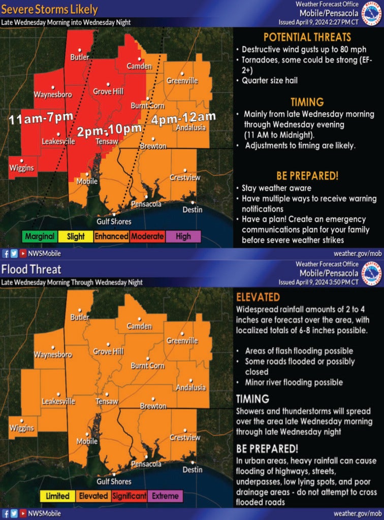
As the attached graphics show the Escambia County, Alabama area should be looking to a window of 4 p.m. to midnight as the timing for the most severe part of the storms moving through the area and potential timing for possible flooding.
Flooding is still a concern with a flood watch in effect from 1 p.m. on Wednesday (April 10) and extending through 1 p.m. on Thursday (April 11).
A wind advisory is also in place for the area from 11 a.m. to 8 p.m. on Wednesday (Apri 10). Winds are expected to be 20 to 30 mph with gusts up to 45 mph. This forecast extends through south central and southwest Alabama, northwest Florida and portions of southeast Mississippi. The impacts from the line of storms will be gusty winds that will blow unsecured objects around. Tree limbs could be blown down and a few power outages may result.
Area residents are urged to secure outdoor objects. Winds at the range expected make driving difficult, especially for high profile vehicles.
Please stay aware of changing weather patterns, weather conditions and have a way to receive warnings.
Also, for those in the south Alabama and northwest Florida area, an on-line meteorologist based in Brewton, Spinks Megginson, is well-known for keeping area viewers weather aware on Facebook under the RedZone Weather page. There is also an app for smart phone users that is free and downloadable that will allow for alerts when conditions are warranted. Please visit https://redzoneweather.com/app/ to download the app for real-time alerts.


